Overview
The South Carolina Department of Natural Resource (SCDNR) is legislatively mandated through the South Carolina Water Resources Planning and Coordination Act (§ 49-3-10, et. seq., Code of Laws of South Carolina, 1976) to formulate and establish a comprehensive water resources policy or water plan for the State. The first edition of the South Carolina Water Plan was published in 1998, and was subsequently updated in 2004 to incorporate experiences and knowledge gained from the severe, statewide drought of 1998–2002. The 2004 Water Plan highlighted the need for water planning on a regional level.
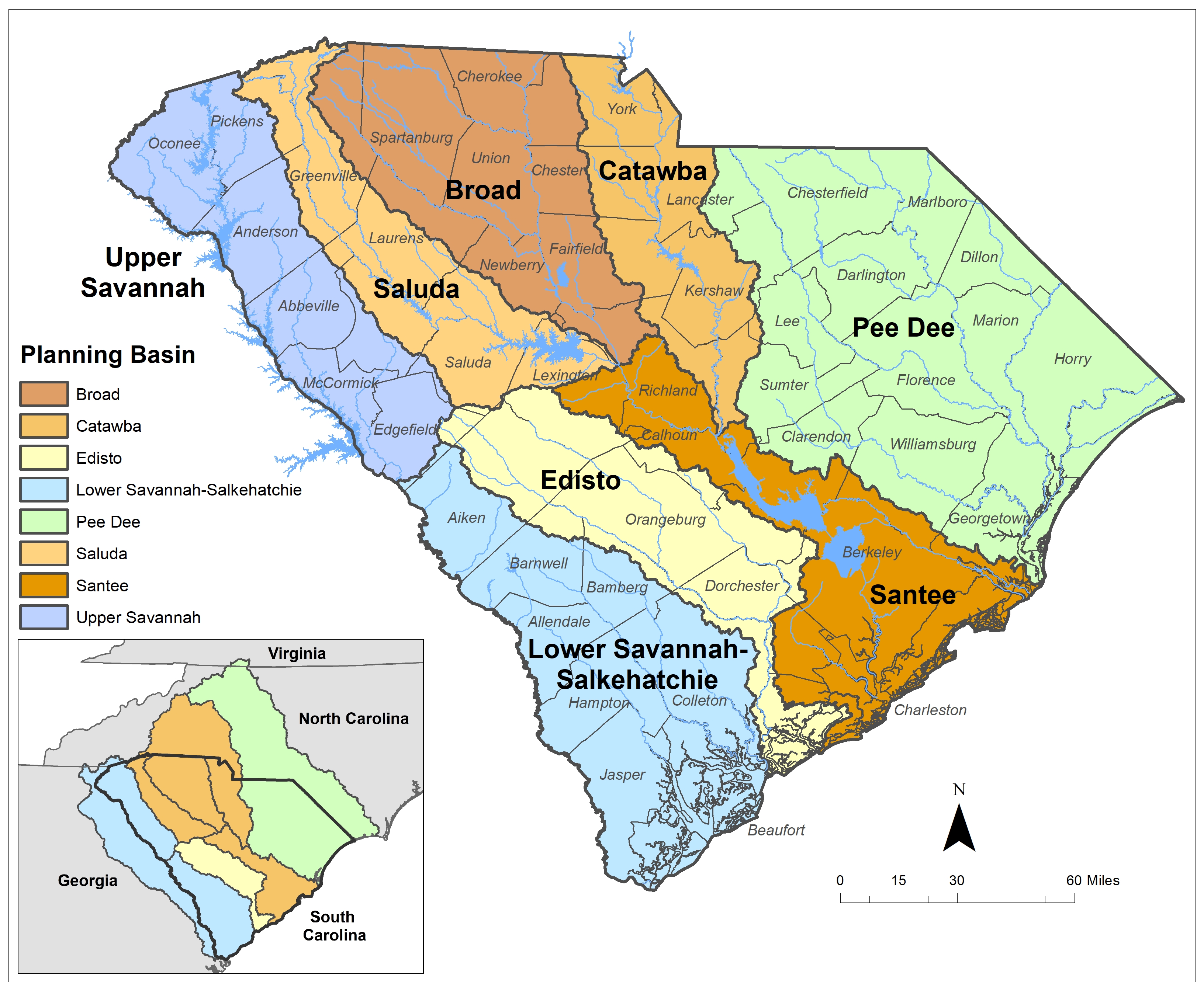
In 2019, SCDNR published the South Carolina State Water Planning Framework (Planning Framework) under the guidance of the Planning Process Advisory Committee (PPAC). The Planning Framework describes the process of developing regional water plans, now formally called River Basin Plans, that will support the development of a new State Water Plan. River Basin Plans will be developed for the eight planning basins in the State – Broad, Catawba, Edisto, Lower Savannah-Salkehatchie, Pee Dee, Saluda, Santee, and Upper Savannah. To support the development of the River Basin Plans, hydrologic models have been developed for both the State’s surface water and groundwater resources and will be used along with water demand projections to assess current and future water availability in the State.
Frequently asked questions about the new State Water Planning Framework and river basin planning activities can be found here. A general description of the eight major river basins in South Carolina can be accessed here.
